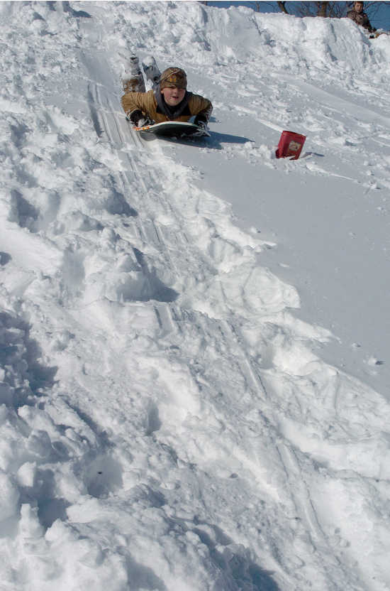
March snowstorm tops list of weather events in 2015

SIKESTON -- This week's heavy rainfall and flooding may be fresh on everyone's minds, but additional weather events had people talking in 2015.
To put it all into perspective, the National Weather Service in Paducah, Ky., recently ranked the region's top 10 weather events for 2015.
However, the list was compiled prior to this week's abundant rainfall, which in Sikeston alone brought 5.62 inches of rain from Saturday through Tuesday, according to the Sikeston Power Station.
Robin Smith, a meteorologist with the National Weather Service in Paducah, said the end-of-the year event may ultimately make the list.
"With all of the heavy rains we've had across the area -- and I'm referring to the mid-Mississippi Valley and lower Ohio Valley and Missouri Valley -- at Cape Girardeau, we're anticipating a record flood event and it will tie the record of 48.5 feet on Saturday," Smith said.
At Thebes, Ill., a record of 47.5 feet is expected to be broken on Saturday also, he said. At New Madrid, a major flooding crest of 47 feet is anticipated on Jan. 5.
"There's a considerable amount of flooding to the west of Sikeston as well," Smith said. There is moderate flooding on the Black River, Current River and St. Francis River, he added.
As weather officials continued on Tuesday to monitor the current weather event, the top weather event rankings remained as follows:
1. March 4-5 snowstorm
A major winter storm dumped 6 to 18 inches of snow across the region. The Kentucky governor declared a state of emergency for the second time in less than a month. Eight to 10 inches was recorded in Scott, New Madrid, Mississippi and Stoddard counties.
Rain gradually changed over to snow during the afternoon and early evening. A few hours of sleet and freezing rain occurred during the transition from rain to snow. Up to an inch of sleet accumulated, followed by snow. During the transition to sleet and freezing rain, some thunder and lightning was observed in southeast Missouri.
Travel became very difficult. Just north of Poplar Bluff, a 10-car pileup was reported on U.S. Highway 67. Numerous vehicles slid off Interstate 55. The southbound lanes of Interstate 55 were blocked at the 105-mile marker after a tractor-trailer crashed. In Stoddard County, U.S. Highway 60 was blocked by a crash involving two tractor-trailers and a sport utility vehicle. The Missouri State Highway Patrol reported 32 stranded vehicles and 27 crashes even before the storm was over. Schools were closed for the remainder of the week in most counties.
2. Feb. 16 winter storm
A major winter storm dumped up to a foot of snow on western Kentucky, southeast Missouri and extreme southern Illinois.
At the Paducah National Weather Service office, the total of 10.8 inches made this the third heaviest snowstorm on record (for snowstorms lasting 2 days or less).
One-half to one inch of sleet occurred at the beginning of the storm from Poplar Bluff east to Murray, Ky. This lowered snowfall totals in those areas to 4 to 8 inches.
Snowfall rates were one to two inches per hour at times, reducing visibility below one-half mile.
Interstate 55 both northbound and southbound was closed at times in New Madrid and Scott Counties. Some 18-wheelers were jack-knifed on Interstate 55 in Scott County, and there were several crashes near Portageville. Across southeast Missouri, the Missouri State Highway Patrol responded to 178 stranded motorists and 78 crashes.
Very cold temperatures in the wake of the storm rendered salt ineffective, slowing down recovery efforts. Wind chills ranged from 5 to 15 above zero.
For the complete story, see the Wednesday edition of the Standard Democrat.

